
SE 7th & Sandy
Depave envisions greener, more livable cities that support more vibrant versions of humans and nature. Walking, biking, skating, rolling, are all forms of non-fossil fuel dependent transportation that are part of the future we must look towards creating in response to climate change. Integrating nature and slower forms of transportation makes our experience of cities healthier and more supportive of life.


2025 design rendering by Knot Studio.
the space today
SE 7th Ave between Stark and Washington Streets exists in the Central Eastside Industrial District (CEID), in Portland’s urban core. Halfway between the Willamette River and tree canopy-abundant residential neighborhoods to the east, this part of the Central City has low access to parks and greenspaces and high populations of houseless Portlanders. The 700 acre, historically industrial area of the CEID, significantly lacks access to greenspace and tree canopy, making it one of the hottest places in Portland due the Urban Heat Island effect.
The intersections surrounding this section of street are considered “high crash” corridors due to challenging sight lines and lack of bike/pedestrian infrastructure. The landscape of this specific part of the CEID sits on a moderate hill that drains into stormdrain inlets connected to the City’s combined sewer system.
Located one-block off the Green Loop on the 7th Avenue neighborhood greenway (a critical bike/pedestrian thoroughfare connecting Blumenauer Bridge and Tilikum Crossing), this area presents critical safety challenges for all street users.
Have you seen the plaza and have feedback about the design and layout? Take a quick moment to give us feedback in this survey:
the project

This project will combine traffic calming, placemaking, and green infrastructure at an over-paved intersection at SE 7th, Sandy Boulevard, and Washington St., in the Central Eastside District of Portland. The goal of the SE 7th and Sandy Green Complete Street project is to bring together a diverse group of project stakeholders, including local business/property owners, community non-profits, design professionals, and City staff to develop an integrated street and intersection design that manages stormwater, boosts tree canopy, improves pedestrian and bicycle connections and safety, and enhances wayfinding and placemaking. This project aims to create a green community plaza and gathering space.
Depave began work on the SE 7th and Sandy project in 2021 under a BES Percent for Green grant. In 2023 we secured additional support from Prosper Portland. Over the last 2.5 years, we have developed preliminary designs for a green complete street and tree-lined pocket park, hosted two successful block parties to help the community re-imagine the space, secured preliminary support from the City for our preferred design, and prepared plans and funding requests to refine the designs and build the project. The current schedule is to construct the new green complete street and parklet in 2026-27.
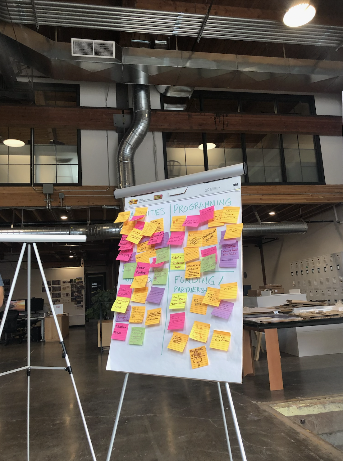
community design process

Over the last three years, Depave has gathered community partners and members of the public to engage in a design process to give input about the future plaza. Above you can see the current 10% design board compiled by Knot Studio, which came out of an early 2025 design charrette with Depave, the Portland Indigenous Market, KPFF, Zucker Engineering, and Kaleido Studios.


February 2025 design charrette at Knot Studio.

2023 community design meeting at the Melody Ballroom.

Depave outreach tent at the first Block Party in 2022. Members of the general public provided design input and learned about the project.
physical context
The Central Eastside (CE) is rapidly transforming into a major employment and housing center of Portland but suffers from hazardous streets, a limited bicycle-pedestrian network, and low access to parks and greenspaces, which all combine to impede the adoption walking and biking by residents, workers, and others who pass through the CE. At present the CE has 900 households and 17,000 jobs, but it will grow to 7,900 households and 25,000 jobs, to become the third largest district for housing and jobs in the Central City by 2035 (Portland Central City 2035 Plan). Streets in the CE suffer from hazardous road conditions, owing to the mix of freight, automobile, transit, bike, and pedestrian movements in and through the District.
The CE is traversed by eight high-crash corridors and PBOT is working to improve safety for all, with a special focus on vulnerable road-users under the Central City in Motion (CCIM) initiative. Limited funding and community resistance to change hinder the pace at which the City can implement needed safety improvements. Street safety for bikes and pedestrians is a particularly acute challenge because without it the City cannot coax more Portlanders out of their cars and into low-carbon transportation modes. The timing of these needed safety improvements is crucial: most need to be implemented soon, before the arrival of new residents and workers so that new mobility habits can be established and secured.
Beyond the needs associated with transportation safety and mode shifts, the CE suffers from low access to parks and greenspaces. The CE has among the lowest tree canopies of any neighborhood in Portland - 7.5%, which is lower than many east Portland neighborhoods where the City is prioritizing tree planting. There are virtually no trees outside of street right-of-way planting strips, owing to industrial and commercial land uses that limit available tree planting on private property. Street trees are few and small-statured, limited by the extent of paving, utility lines, and skinny planting strips.
Access to parks and open spaces is similarly constrained in the CE. The only parks are the Eastbank Esplanade, Burnside Skatepark, and Francis and Clare Commons - which are all relatively small or have limited amenities. One quarter of a mile east is the old Washington-Monroe High School site (which hosts an undeveloped grass field with an unsanctioned dog-off-leash area and no other amenities). Near NE 12th and Glisan St is the Portland Tennis Center and Buckman Field (which has a sports field, small playground, and picnic tables but is distant from most of the CE). The Green Loop circles through the Central Eastside, but the alignment features many fewer greenspace connections as compared to other Districts in the Central City.


Portland Indigenous Marketplace
Portland Indigenous Marketplace (PIM) has moved next to the Future Green Plaza and exists as an anchor business and collaborator on the activation and future design. PIM supports Indigenous artists and entrepreneurs by providing barrier-free, culturally respectful spaces that encourage cultural resilience and economic sustainability by promoting public education through cultural arts.

Eastern facing perspective of the plaza, looking towards 737 SE Sandy, future home of the Portland Indigenous Marketplace.
historical context
Long before settlers colonized and displaced the existing inhabitants of the “Oregon Territory,” an indigenous trail connected the Willamette River to the Sandy River Delta, in the land that has come to be known as Portland, OR. That trail was established as one of the cities first roads and is now called Sandy Boulevard.


Located on the eastside of the Willamette River banks, the Central Eastside Industrial Distict was a maritime hub for shipping and commerce in Portland’s early days of the late 1800’s. Italian immigrants moving to Portland around 1913, began establishing truck farms that supplied fruit and vegetable wholesalers in a bustling new riverside industrial district that became to be known as “Produce Row (Portland Street Art Alliance). In 1981 it was officially declared in as an ‘industrial sanctuary’ an effort to maintain its unique land use and character. Warehouses and storage facilities were a significant part of the district’s beginnings, and the area provided a variety of blue-collar jobs (Jones, 2014).

Today, the Sheridan Fruit Company at 409 SE MLK Blvd is the last of Portland’s ‘old-school’ produce markets. In 1916, John Sheridan started an open-air produce market on Union Avenue (now MLK Blvd). In 1946, the Poleo Brothers, whose family still owns and operates The Sheridan Fruit Company today, purchased the company and began a wholesale operation in 1950.
events at the plaza
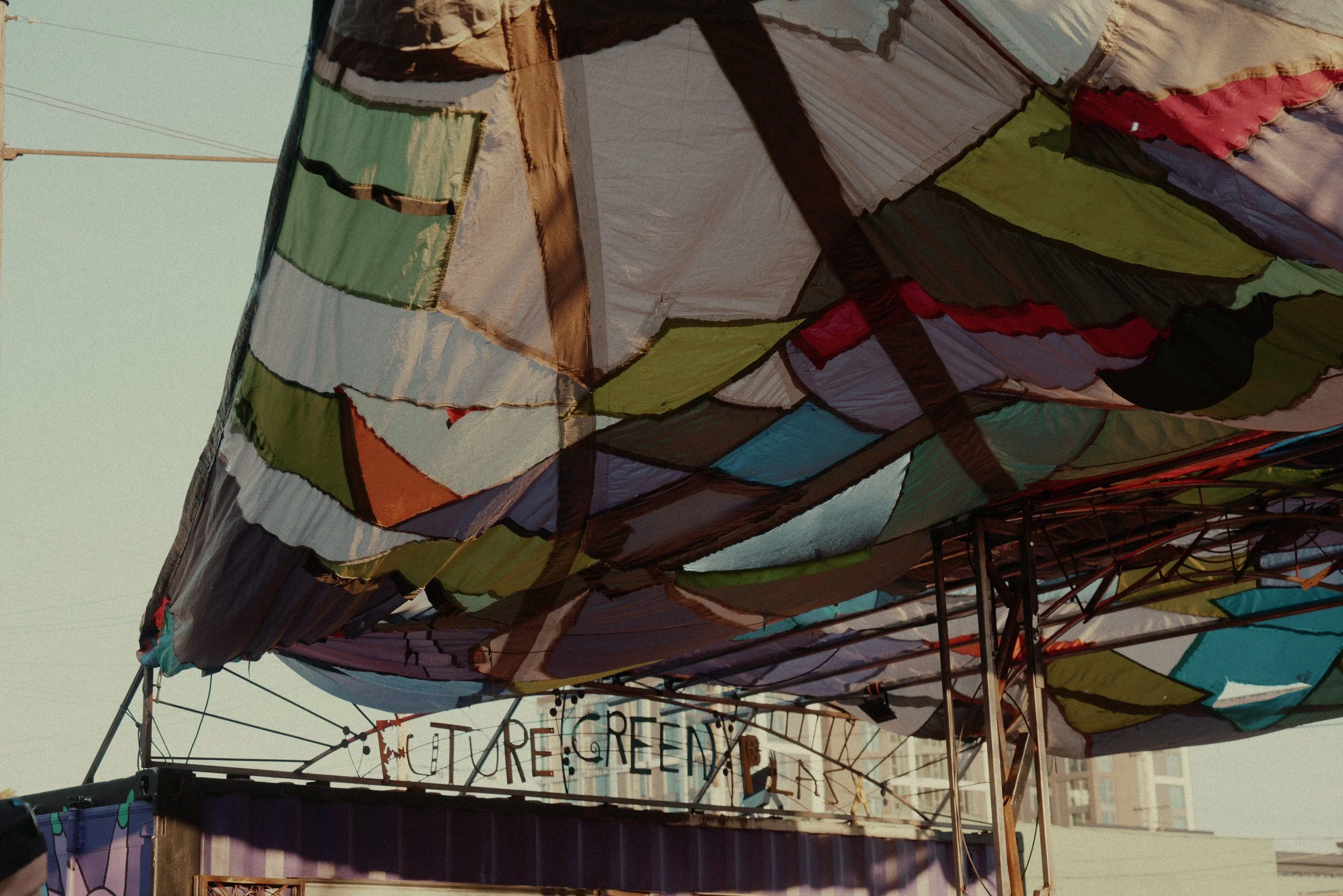
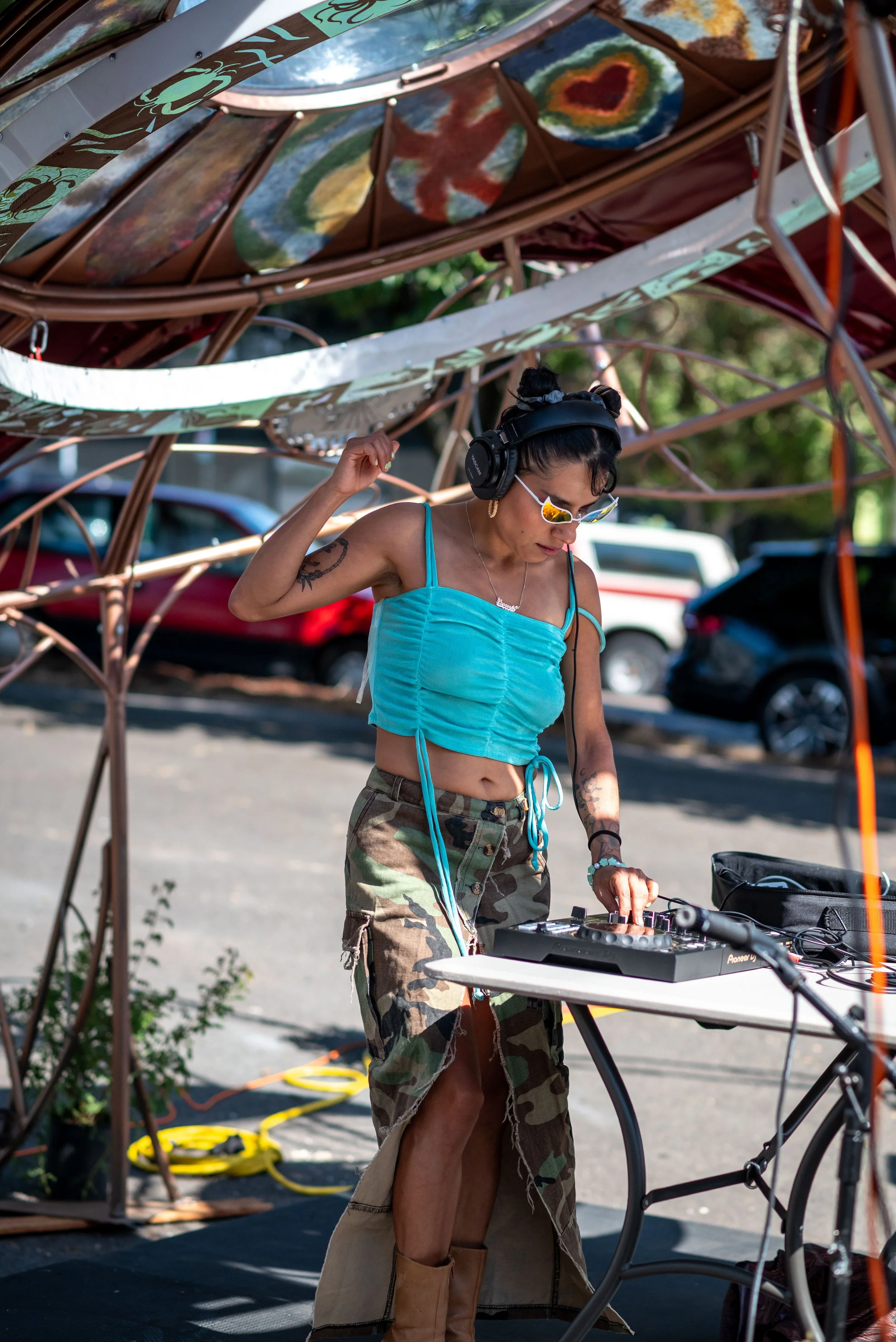
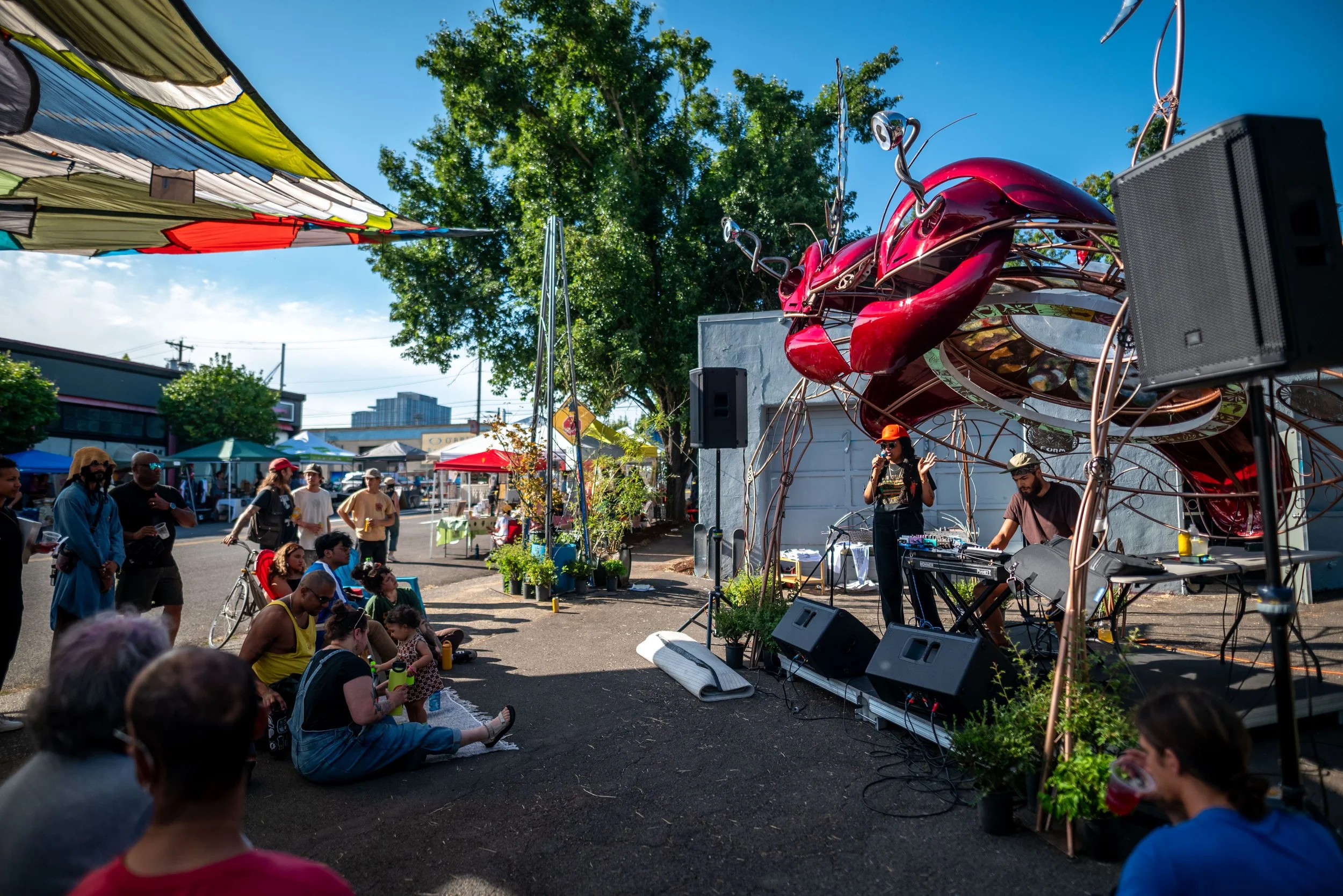
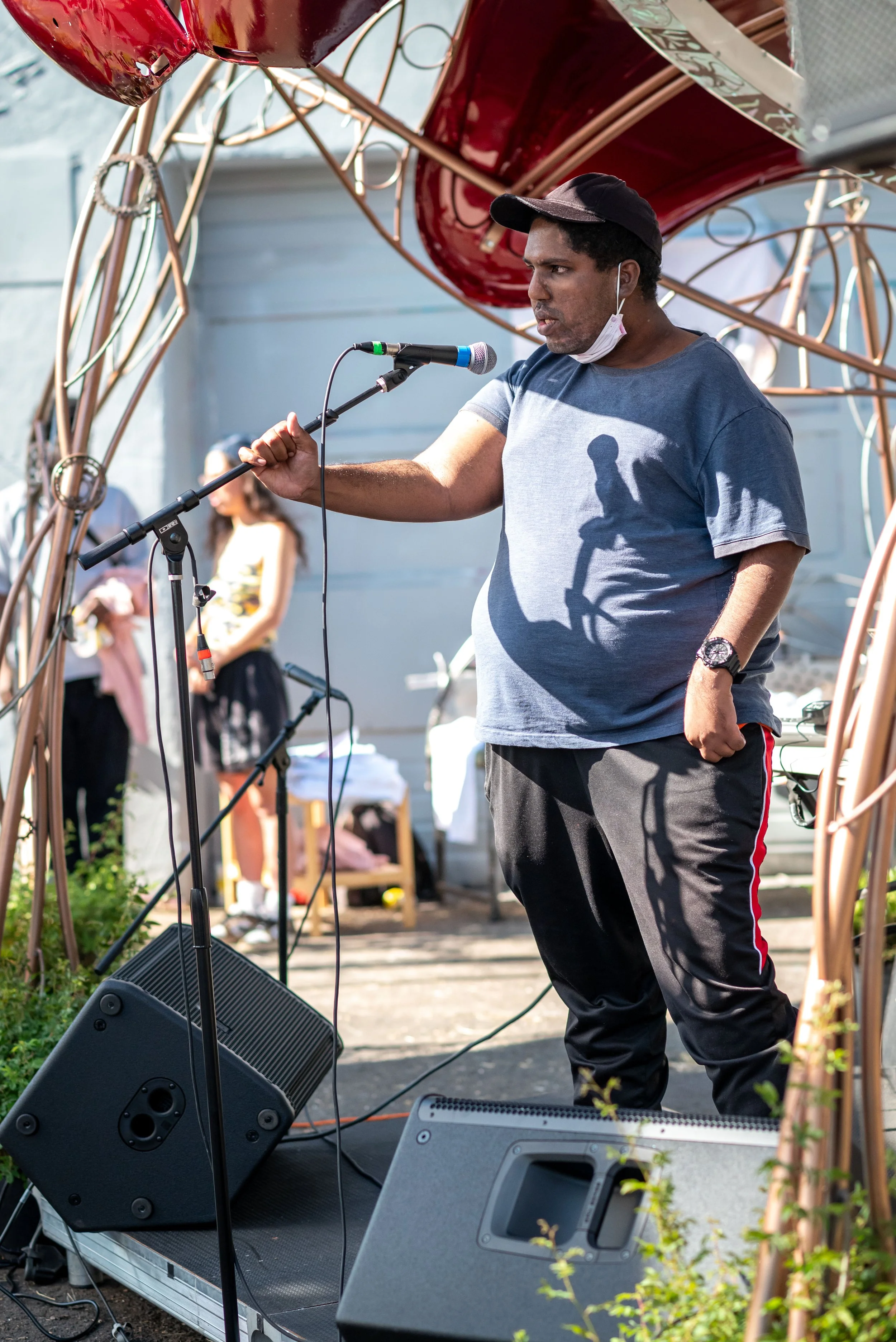
During the summer of 2025, Depave returned to the street to activate the space and demonstrate our ‘future green plaza’ at SE 7th Ave and Sandy Blvd through a variety of built and programmatic activities from August 9 to September 19. This year, the project team worked with local artists and designers to install a stage, skatepark, shade structures, Stay On the Grass greenspace planters and pollinator habitat through a collaboration with POIC! During the month and a half long closure, the street installation mirrored the footprint of the future plaza.


sponsors and partners, thank you
Zucker Engineering & Design
